Skip to content
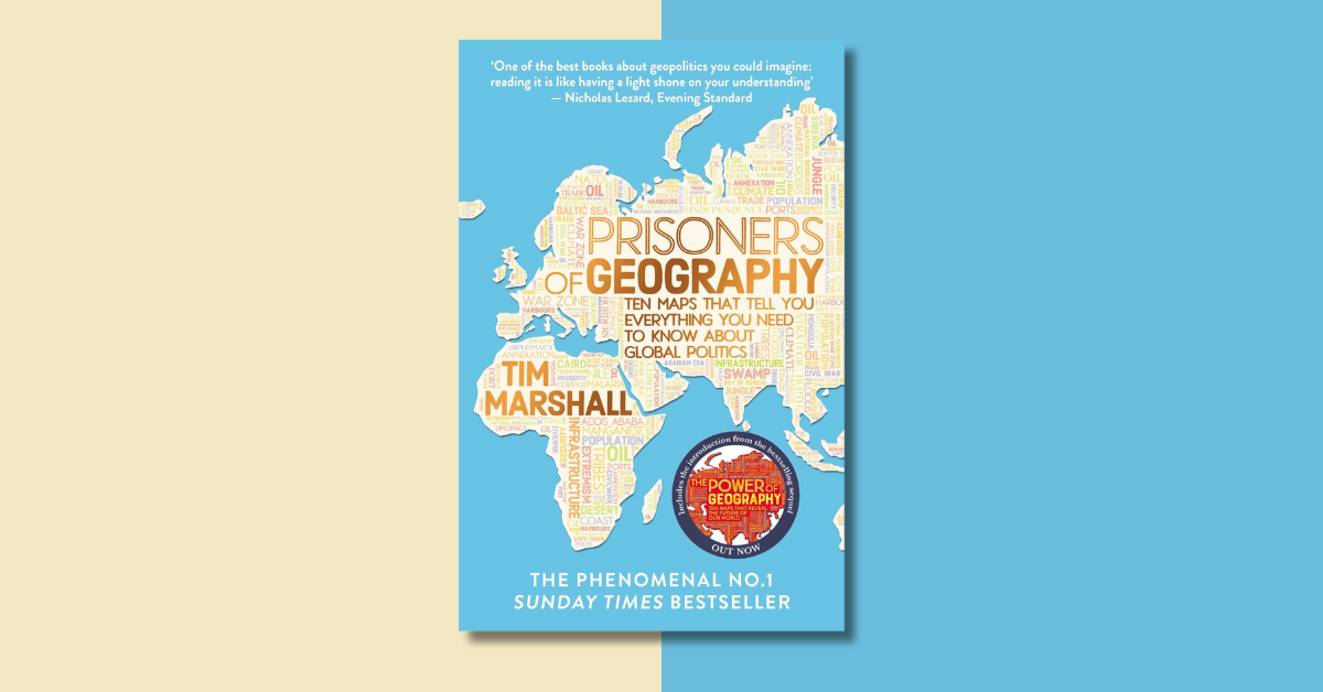
Quick Summary: Prisoners of Geography by Tim Marshall explores how the geography of the world has shaped global politics.
Using ten maps, the book examines historical and current political issues, the impacts of colonialism, and the role geography plays in everything from wars to alliances.
It’s like a Johnny Harris video in book form, offering bite-sized geopolitical insights.
Tapan’s Verdict: Dig Deep 🧐
🚨 Quick sidebar: Finding this book summary helpful? You should subscribe to my newsletter to get similar actionable insights from books.
Psttt, you will also get a free copy of my ebook, Framework for Thoughts, when you sign up!
Prisoners of Geography: Actionable Insights
Colonial Borders and Their Consequences
Marshall highlights how colonial powers recklessly carved up nations, creating borders that ignored local cultures, ethnic groups, and histories. For example:
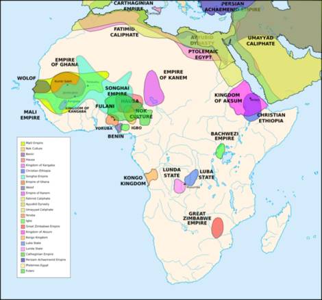
The Democratic Republic of Congo: Colonial lines lumped over 200 ethnic groups into one nation. This lack of unity set the stage for ongoing wars, including the devastating “African World War.”
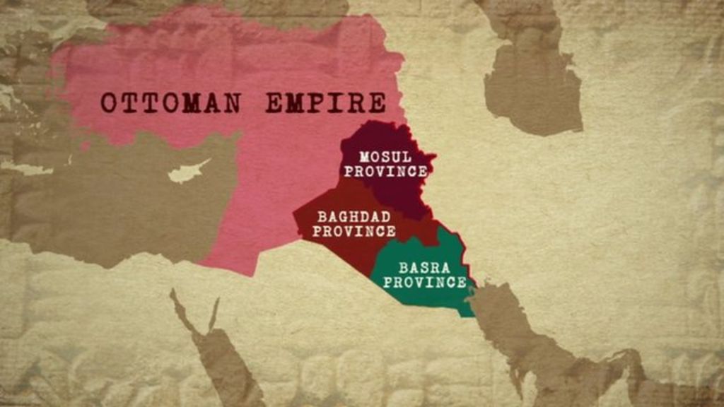
Iraq: Post-Ottoman British and French rulers drew arbitrary borders through the Sykes-Picot Agreement, forcing Kurdish, Sunni, and Shia populations into one nation. The region’s instability today reflects these thoughtless divisions.
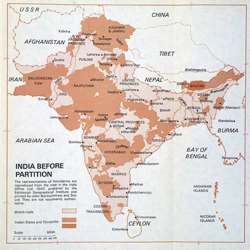
India and Pakistan: The rushed partition led to chaos, mass displacement, and a conflict-ridden Indo-Pak border that still divides a shared history and culture.
Geography as a Prison
Geography can dictate a nation’s opportunities or struggles.
Russia’s harsh climate and lack of warm-water ports have shaped its expansionist policies, while the U.S. benefits from being naturally shielded by oceans.
Marshall underscores the role of natural barriers, rivers, and access to resources in determining power dynamics between countries.
Marshall’s discussion of geography’s role in shaping global politics echoes similar themes in the book, The Ocean of Churn, which explores how the Indian Ocean has been a crucial axis for trade, war, and cultural exchange throughout history.
A Better Lens on Global Conflicts
Geography doesn’t explain everything, but it offers context.
Understanding how mountains, rivers, and deserts divide or unite people can make complex issues (e.g., Kashmir or Ukraine) easier to grasp.
Human Cost of Arbitrary Borders
The book discusses how colonial decisions haunt former colonies—millions displaced during the partition of India, ethnic tensions in Iraq, and tribal conflicts in Africa.
These stories highlight how “lines on a map” have left scars still visible today.
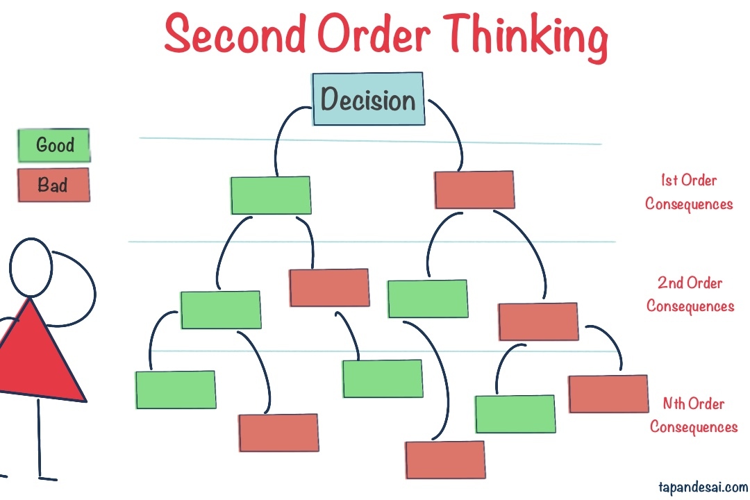
It also shows the importance of thinking beyond immediate outcomes. Colonial powers failed to consider the second-order consequences of their actions—how hastily drawn borders would lead to ethnic tensions, civil wars, and humanitarian crises.
Memorable Quotes
The Europeans used ink to draw lines on a map: they were lines that did not exist in reality and created some of the most artificial borders the world has seen. An attempt is now being made to redraw them in blood.
Islam, cricket, the Intelligence Service, military, and the fear of India are what hold Pakistan together.